
Lake Effect Snow and Mesovortices On Lake Michigan
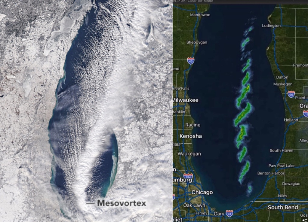
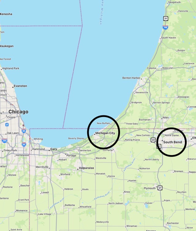
Lake Effect Snow took a rare form last week. Canadian Whirlwinds or mesovortices formed over Lake Michigan Jan 19 2024 as it “cooled” or gave up some of its stored heat because just the right ingredients of weather converged. Cold air from more than one direction blowing over relatively warm water (warm relative to the arctic air) created the series of whirlwinds which can be seen on the satellite and radar images. The vortices create incredible snow amounts over short periods where they form. The odd snow squalls were caused by ‘converging winds which were also angled, behaving like two hands rubbing a rope of dough. According to a published article in the Bulletin of the American Meteorological Society Vol 132 (9) 2004, winds within the wind-parallel band region might be about 10 mph near the surface increasing to around 20 mph at one mile altitude. Mesovortices which are Lake Effect produce “locally” heavy snows. Michigan City got three feet of snow while nearby South Bend received only 6 inches.

Leave a comment