
Lake Effect Snow
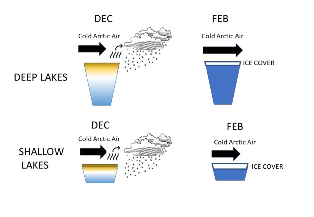
Why do North America’s “Lake Effect Snows” seem most severe in December and January? “Lake Effect Snowstorms” occur mostly around the Great Lakes in the United States during the months of December and January. The meteorological ingredients needed are cold air blowing across a large volume of “relatively” warm water. Lakes Superior, Michigan, Huron, Erie and Ontario might not seem “relatively” warm In December but they are in terms of their annual cycle of water temperature in relation to the air temperatures. Water by the very nature of its physical properties has a very high “Heat Capacity.” This means water warms slowly and cools slowly. Water temperatures are still cooling downs in North America’s lakes and reservoirs in December. Cold north winds pick up moisture which evaporates off the lake (left side of illustrations), cools into snow flakes and falls downwind of the lake. Eventually the lake will cool substantially as the winter progresses. If ice cover forms (right side of diagrams) the capacity to produce “lake effect” snow is reduced and then eliminated as ice cover grows. The deeper the lake the more thermal mass is stored in the lake. The thermal mass of water which is warmer than air and the dictates the magnitude and duration of the “lake effect snow” season. Individual “lake effect” events are influenced by the “fetch” or distance that the cold air blows across the water. Deep lakes like Superior (> 1000 feet), Huron and Ontario (depicted in the upper portion of illustration) have more capacity to produce lake effect snow than Lake Erie. Lake Erie’s deeper eastern basin and Lake Ontario combine to produce lots of lake effect snow for the state of New York, especially if the prevailing cold winds are blowing west to east and thus increasing the “fetch.” Since winter’s cold air tends to blow from the North and West, lake effect snows are more common along Lake Superior’s southern shore, and Lake Michigan’s eastern shore. The same applies to Lakes Huron, Erie and Ontario. Theoretically, the warmer the Great Lakes become over the course of late spring and summer, then the longer they will provide warm moist air as they cool in the late Fall and early Winter, and hence more Lake Effect Snow. There are “ocean-effect” and “bay-effect” snow storms too. The west coast of northern Japan experiences serious sea-effect snow from cold air crossing the Sea of Japan. The Black Sea, Caspian Sea, Baltic Sea and North Sea also produce ocean-effect snow events.

Leave a comment